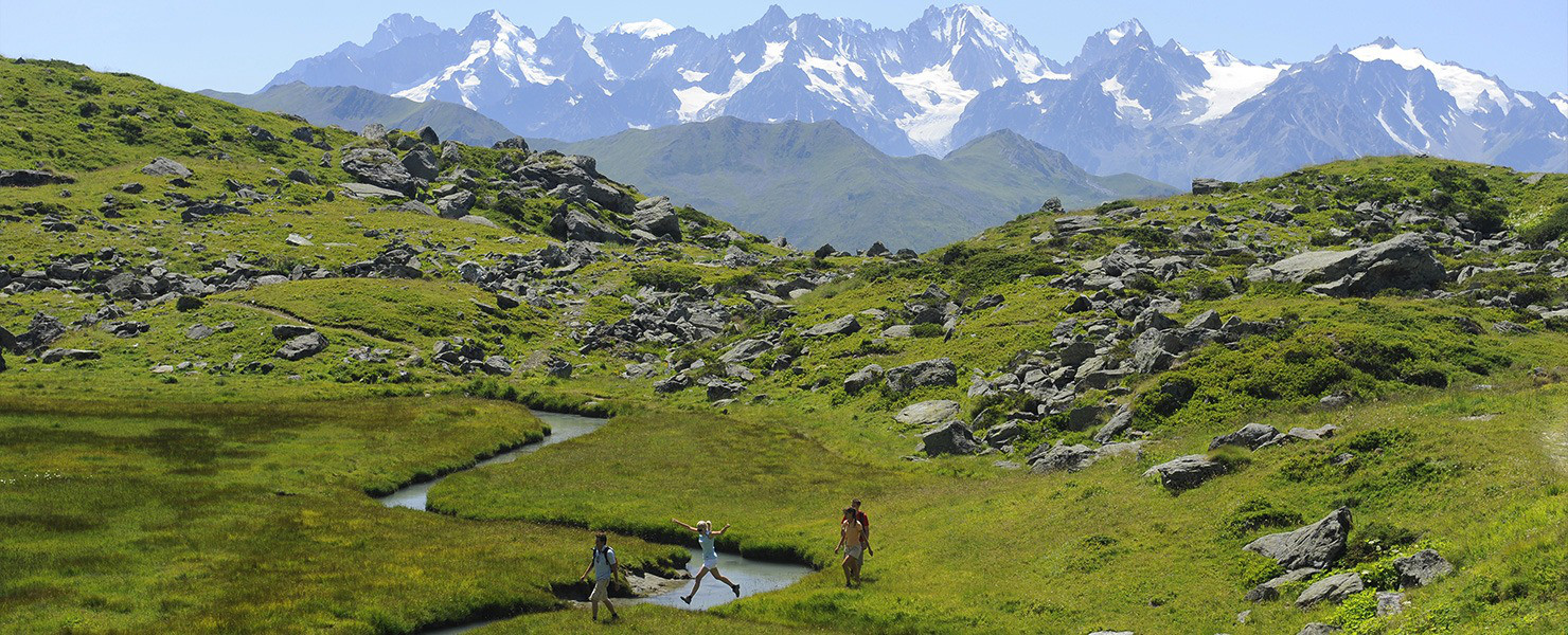
The heights of the Val de Bagnes
under the eye of the chamois
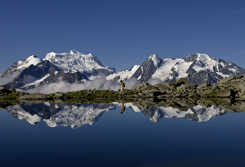
Up on the heights of the Val de Bagnes, houses give way to larch forests and steep slopes lined with scree and topped by soaring peaks. Through this wild and magnificent landscape winds the Sentier des Chamois, a mountain path that takes hours to negotiate and where the eye is inevitably drawn to the glistening, snow-covered Combins range.
A summer day dawns, with the cool of the night gently giving way to the heat of the sun. Rolling down from steep slopes and still immersed in deep shadow, the open expanse of the Val de Bagnes has the look of an impenetrable no man’s land. Before long, however, the first rays of sunlight appear from the distant east, from behind mountainous barriers, warming the peaks and revealing walls of lichen-covered rock. High up on an overhanging cliff can be seen a chamois, the figure of which stands out sharply against a brilliant blue backdrop.
Created in 1968 and covering an area of 150 km2, this nature reserve is often overlooked by holidaymakers transfixed by the panoramic views offered by Verbier, not least of Mont-Fort. Here, however, lies an authentic, tranquil land of timeless mountains, where chamois mingle with ibex (reintroduced in 1926) and marmots.
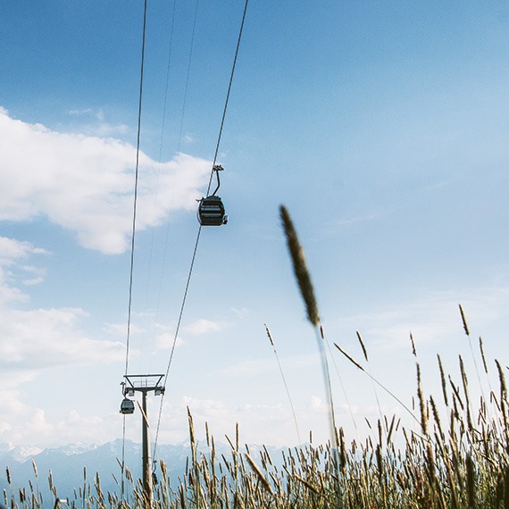
Le Sentier des Chamois
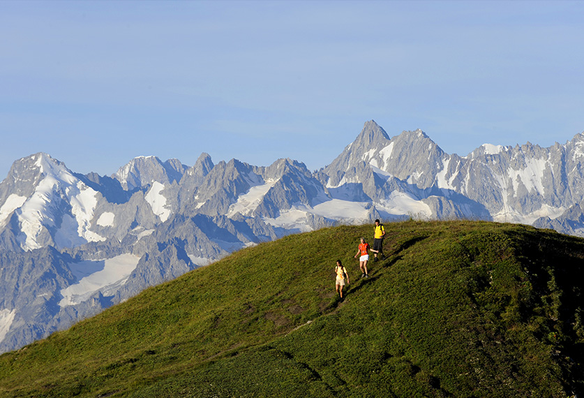
Etched into the valley’s high northern slopes, the Sentier des Chamois links La Chaux (served by a gondola lift) to the delightful village of Fionnay. Stretching for 13 kilometres and taking between five and six hours to complete, it is not so much a bracing walk as a hike in the true sense of the word, one that winds its way between two imposing mountain ranges: the Mont-Fort, rising high above, and the Combins, which lie opposite.
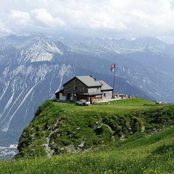
The first section of the path runs down to the Le Mintset by the old irrigation canal, before climbing back up through Crêta d’Inyé and La Perraire. It’s not too strenuous and all you have to do is follow the white/red/white markers. There are some, however, who prefer to start by branching off to the Cabane du Mont-Fort (2,457 m) and the Patiefray marsh. This mountain hut, with its imposing walls of rough-hewn stone, is the perfect spot for enjoying a mid-morning rest and, in the early summer months, watching tufts of cotton grass dancing in the gentle moist breeze. There is a high risk of falling rocks on the trail back to the main path, however, for which reason it is now staked out with blue markers.
Before long, another sparkling obstacle hoves into view: the northern slope of the Grand Combin, lined with blocks of ice that have broken away from the Corbassière glacier and thick patches of powdery snow, all of which means you have to look where you put your feet. The path runs through grassy slopes and steep scree, inevitably slowing down progress, before rising on the long climb up to the Col de Termin (2,648 m), where the landscape becomes increasingly rocky and silence reigns supreme, broken only by the clacking of stones sent careering down the slopes by unsuspecting ibex. While it is not hazardous, the climb to the top is breathtakingly steep, with chains provided to help walkers negotiate two elevated sections.
Right at the foot lies a broad expanse of emerald green, at the bottom of a rocky valley, an oasis known as the Lac de Louvie (2,250 m), which is overlooked by the sunlit terrace of the hut nearby. It’s an ideal stopover for the night, eyes fixed on the Grand Combin. From here there are two hours of strain for the knees to endure on the steep final descent to Fionnay (1,489 m).